Google Earth Features
Navigation Controls
Use the controls on the right side of the screen to navigate.
- Look Joystick - turn 360 circle (notice location of north)
- Move Joystick - move around
- Zoom Slider - move closer and farther
Places
- Use the search box. Enter a location and click the magnifying glass. The results will appear int he Places panel.
- Under the Places area, notice the Sightseeing Tour. Click Start Tour Here to see the tour.
Layers
- Explore the layers provided by Google. Use the checkboxes to turn these on and off.
Placemark
Use the placemark option to keep track of places you want to visit again.
- Press the Placemark tool (looks like a yellow pin).
- Move the placemark to the correct location and click the mouse.
- Enter information into the window.
- Notice that the placemark will appear under My Places.
- To add folders, pull down the Add menu and select Folder. Name the folder and drag places into the folder.
Identify a place in your local community. Create a placemark. Include descriptive information.
Ruler
Use the ruler to identify distances between places.
- Zoom into your first destination, click the Ruler tool. Place the first marker.
- Locate your final destination. Place your second marker.
- The distance will appear under Path.
Brainstorm ways to use the ruler in teaching and learning.
KML/KMZ Files in Google Earth
You can create KML files with the Google Earth user interface, or you can use an XML or simple text editor to enter "raw" KML from scratch. KML files and their related images (if any) can be compressed using the ZIP format into KMZ archives. To share your KML and KMZ files, you can e-mail them, host them locally for sharing within a private internet, or host them publicly on a web server. Just as web browsers display HTML files, Earth browsers such as Google Earth display KML files. Once you've properly configured your server and shared the URL (address) of your KML files, anyone who's installed Google Earth can view the KML files hosted on your public web server.
Many applications display KML, including Google Earth, Google Maps, Google Maps for mobile, NASA WorldWind, ESRI ArcGIS Explorer, Adobe PhotoShop, AutoCAD, and Yahoo! Try the KML Tutorial or read KML Documentation.
Locate KMZ files
- Open Google: Advanced Search.
- Enter the topic such as volcano or geometry
- Choose File type: KML or KMZ.
- Press Advanced Search
- You can also enter it by hand such as geometry filetype:kmz
Explore an example project. Watch Tutorial 1 and 2 from the Christmas Card project for a great explanation of creating and sharing KML files
Share a KML/KMZ file.
- Set a placemark.
- To save a placemark, pull down the File menu, choose Save and Save Place as... If you wish to save the entire contents of My Places, choose Save My Places.
- To email this placemark, choose the email tool (envelope). This will launch email software, open a new message, and attach a KMZ file of your placemark. You can also choose to send a JPG or a snapshot of the 3D view.
- To share on the web, save your places. Upload the .KMZ file to a website. Create a link to the .KMZ file.
- To share your places on a network server, save your places to the network server where others can access the .KMZ file.
Google Earth
Although Google Earth is the most popular, there are other software application such as WorldWind - virtual globe from NASA (images are public domain) and Microsoft Bing Maps from Microsoft.
Google Earth - a geographic browser. KML (Keyhole Markup Language) is similar to HTML and is used to access examples.
Educators can get Google Earth Pro for free. Learn more. Download PDF.
Educators can get Google Earth Pro for free. Learn more. Download PDF.
Google Earth Showcases and Galleries
- Google Earth Gallery - locate tours
- Google Earth Outreach - (Be sure to go to the Education & Culture section; also check out Current Affairs, Environment & Science, Global Development, Public Health, and Social Services sections)
Google Earth Blogs and Forums
- Google's Lat Long Blog - ongoing information about Google Earth and Maps
- Google Earth Community - discussion forum (locate discussions by topic area)
- Google Earth Blog - an unofficial Google Earth website.
- Google Sightseeing - lots of places to explore (ads)
Google Earth for Educators
- Google Earth - Getting Started for Educators
- Google for Educators - Geo Education - resources for teaching with Google Earth, Google Sky, Google Ocean Tour, Google Maps, and Google Sketchup
- Google Earth Educators
- Geo Education Home - Information on using Google Earth, Maps, Sky, and SketchUp in your K-12 classroom.
- Ideas for using Google Earth in Classroom (PDF)
Google Earth Educational Resources
- Classroom Google Earth - This wiki is collecting ideas for using Google Earth in the classroom.
- My Wonderful World
- PBwiki Cartography
- Juicy Geography: Google Earth Lessons by Noel Jenkins
- Google Earth Lessons - connects to other sites
- Google Earth Lessons
- Educational Uses for Google Earth
- JLWagner's Google Earth Bookmarks
Other Resources for Google Earth
- Google Earth from Wikipedia
- How Google Earth Works from How Stuff Works
Open Google Earth. Take a virtual trip around the world. Start in your state, country, continent and beyond. Explore lots of examples in the Gallery and Outreach areas.
Search for places in the world you'd like to visit such as Paris. Or places you study such as Rome.
Search for places in the world you'd like to visit such as Paris. Or places you study such as Rome.
GIS and Fine Arts
Whether you want to visit art museums, explore architecture and scupture, or be inspired by landscapes, explore Google Earth.
Search for the Eiffel Tower in Paris and the Museum Prado in Spain.
Ideas
- Use satellite images as art
- Examine patterns in the natural and human-created world
GIS and Social Studies
There are endless applications of GIS in Social Studies.
- Use Google Earth to examine a state or country. Identify what you think are important issues for this place.
- What trails lead west? Speculate why each trail was taken. Use images as evidence.
- The key is building connections. Where were the concentration camps during the Holocaust of WWII? Use Google Earth for the locations such as Birkenau and Auschwitz.
- Trekking the Oregon Trali (KMZ) is a great example of using Google Earth. Also check out a great example of using Google Earth to make maps.
- Explore the Pacific Crest National Scenic Trail (KMZ).
Historical Map Collections
- Map Collections from Library of Congress
- Perry-Castaneda Library Map Collection from University of Texas
Compare historical maps with Google Earth images focusing on changes in natural areas and urban areas. Many maps are available in Google Earth. Look for Rumsey Historical Maps from the Gallery in Google Earth.
Explore Creating a History of Hartford.
Go to the Civil War Literature Wiki. Explore historical fiction books set in different regions of the United States. Use Google Earth to explore specific battles and explore relationships. Examine books with a midwest setting:
- Across Five Aprils by Irene Hunt (Illinois)
- Captured! A Boy Trapped in the Civil War by Mary Blair Immel (Indiana)
- Guerrilla Season by Pat Hughes (Missouri)
- The River Between Us by Richard Peck (Illinois)
- Soldier's Heart by Gary Paulsen (Minnesota)
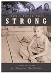 Use Google to locate a wide range of multimedia resources including visuals, maps, and videos. Let's say you're doing literature circles on the topic of Civil War and students are working on the CivilWarLit wikispace. One group might be reading the book "How I Found the Strong" by Margaret McMullan set in Mississippi during the Civil War. Another group might be reading "Shiloh Attack: Battle of Shiloh" by Hama, Wagner, and Moore. Students might search for resources about the key battles (Battle of Shiloh) discussed in the book.
- Google Book Search: How I Found the Strong
- US Government Google Search
- Search for government resources from National Parks, the Library of Congress, NOAA, NASA, CDC, Military sources and more.
- Google Earth
- Search for "Smith County Mississippi"
- Search for "Battle of Shiloh"
A Single Shard by Linda Sue Park is set in Ancient Korea. Trace the journey of the young character. Compare Korea then and now through maps.
Read books set in the Great Depression. Compare the movement of people in different books including Grapes of Wrath, Out of the Dust, and Bud Not Buddy. Think about what would happen if book characters interacted. Map their movements and interactions.
Read Crossing the Wire by Will Hobbs. Also, explore Immigration Stories from ALA. Use Google Earth to explore a possible immigration path between two countries such as Mexico and the United States.
Other books might include Grandfather's Journey. Use Google Earth the visualize the journey. Then determine the miles. Create your own map with distance information and drawing.
Explore historical events from different perspectives. For instance, trace the steps of immigrants through Ellis Island as well as Angel Island. From what other directions did immigrants arrive in the United States? Look at your own community. How was it formed? Create a document exploring different perspectives. Use GIS tools in your exploration and sharing.
Explore websites with companion Google Earth tours
- Encompassing the Globe: Portugal and the World in the 16th and 17th Centuries and Google Earth KML
- Marshall Gold Discovery State Historic Park and Google Earth Tour
Google Earth Examples
The following links will launch Google Earth
- Google Earth Gallery (KML or KMZ files)
- Other Google Earth Tours
- 360 Cities - 5000+ panoramas
- Boston Freedom Trail - Revolutionary War (KML file)
- Ghana
- Most Extreme Places on Earth (KML file)
Social Studies Ideas
Explore the following ideas. Let's add more!
- Civics
- Crime rates
- Land use issues
- Transportation: travel routes
- Planning
- Wildlife corridors
- Economics
- Planning
- New business/building location
- Business areas, saturation, consumer trends, market areas, competition
- Planning
- Geography
- Planning
- land use and zoning
- Analyze spatial relationships (geology, flora, fauna, humans)
- Seek spatial patterns (distributions)
- Planning
- History
- Analyze current events
- Conflicts - relationships between countries
- Issues - poverty, urban blight
- Conditions - water access and use
- Analyze historic events
- War battles and battlefields - examine decisions and explore alternatives
- Tracing Epidemics - Spanish Influenza (1918), London (1854) - plotted distributions of deaths on map
- Disaster Debris Fields - Titanic, Space Shuttle Columbi
- Analyze changes over time (time-series analysis)
- Movement of people
- immigration
- Growth of cities
- Changes in coral beds
- Movement of people
- Analyze current events
No comments:
Post a Comment